
One of the most common questions I receive is “why should I purchase commercial satellite imagery, rather than use a free source of imagery?” In the first part of this series, I will discuss two of the things I typically discuss in response: resolution and accuracy.
Resolution
What is resolution? Simply put, it is the relationship between a pixel on your screen, and its size on the ground. For example, an image with a spatial resolution of 50 cm means that every pixel on your screen is equivalent to 50 cm on the ground.
Why is resolution important? The higher the spatial resolution, the smaller the features you can detect. Freely available satellite imagery on the internet typically ranges from 60 cm to 15 m. Our partner, Maxar, currently operates a constellation of four satellites capable of 50 cm or better resolution, including WorldView-3 which is capable of collection 30 cm. For many applications, the kind of resolution you get with free imagery just won’t cut it.
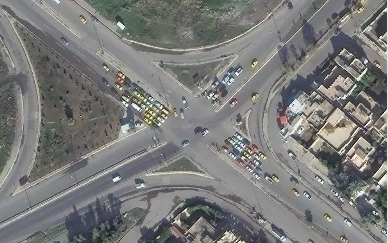
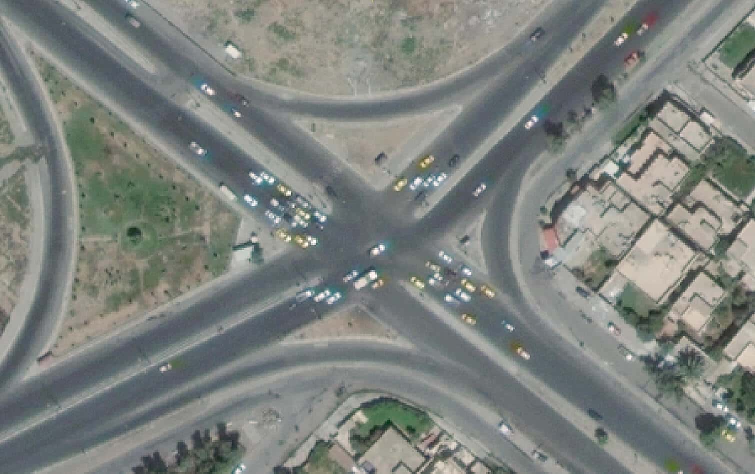
Check out these images of a traffic intersection that compares 50 cm to 30 cm. While the 50 cm imagery allows you to clearly see the outlines of buildings, the 30 cm imagery enables you to make out walls and finer details on the roofs of these buildings. Also, the increased detail in vehicles is apparent when using the 30 cm imagery. Windshields and truck beds are easier recognized which helps in identifying the different types of vehicles.
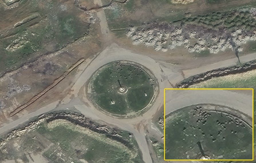
Here is another interesting 30 cm shot of a traffic roundabout in the Middle East where you can count the number of livestock grazing on the grass.
Accuracy
Although pixel size is extremely important for identifying features, it is also critical to know how accurate those pixels are relative to their true location on the ground. An inaccurate image is simply a pretty picture. When making important decisions for any project, accuracy should always be top of mind.
Maxar’s high resolution satellites, are the most accurate commercial satellites in orbit today. The DigitalGlobe satellites are accurate within 3-5m without ground control. Older satellites and many of today’s microsatellites can be off by 20m (or sometimes more). When available, PacGeo can also use ground control to improve any satellite data – a level of accuracy that will not be found with free data sources.
With free sources, you ultimately do not have enough information to determine the accuracy of the imagery. Coming from my military background, I always ask why would you use the unknown for making critical decisions that could risk personnel?
So what’s the takeaway?
When acquiring imagery for a project, you must choose something that meets your needs. First, it must be at a suitable resolution such that you can identify the specific features you want (perhaps livestock?). Second, you need to ensure that whatever data you choose to use meets the accuracy that you require for making decisions. In my experience, free imagery simply does not consistently fulfill the needs of users for these reasons. I will touch upon another reason for choosing commercial imagery in a future post – the currency of the imagery.
Still have question? Just ask and we can advise you on the options to meet your requirements and your budget.

