

AW3D Enhanced
AW3D Enhanced DEM products are among the world’s highest resolution and most accurate 3D digital maps derived from satellite data. Leveraging a vast archive of satellite imagery and advanced processing technologies, AW3D Enhanced provides Digital Surface Models (DSM) and Digital Terrain Models (DTM) with resolutions as fine as 50cm. This data is ideal for applications requiring precise geospatial information, including infrastructure planning, disaster management, environmental simulation, and security analysis. With global coverage and extensive customization options, AW3D Enhanced ensures that your projects are supported by reliable, high-quality geodata.
Precision DSM and DTM at 2 m, 1 m, and 50 cm native resolution
Best-in-class accuracy for medium to large-scale mapping
Delivered in standard GIS formats with ortho and contour options
Custom orders with new tasking and flexible AOIs
Fast turnaround, even for customized requests

AW3D Enhanced Specs
Product type
Digital Elevation Model (DEM):
Digital Surface Model (DSM)
Digital Terrain Model (DTM)
Resolution
50 cm, 1 m, 2 m
Coverage
Global, feasibility study required
Satellite data
Maxar WorldView Constellation
Accuracy
With ground control points (GCPs):
Absolute: 1.5 m LE90 / 1.5 m CE90
Without ground control points (GCPs):
Absolute: 3 m LE90 / 3 m CE90
Options
DSM + DTM
Tasking
Contour lines
Ortho-image (30 - 50 cm)
Minimum AOI
DSM: 25+ km²
Minimum width: ≥ 2 km
Format
GeoTIFF (32-bit float)
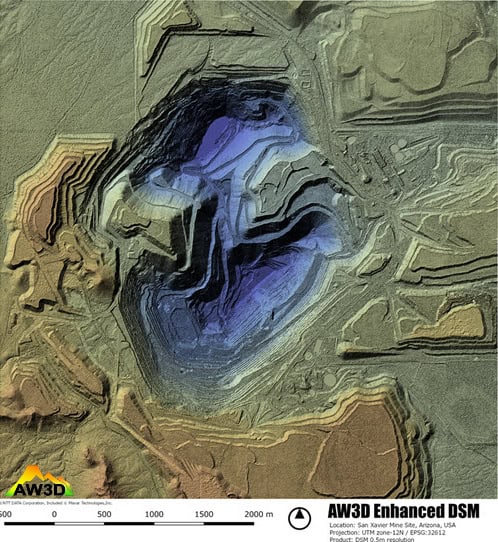
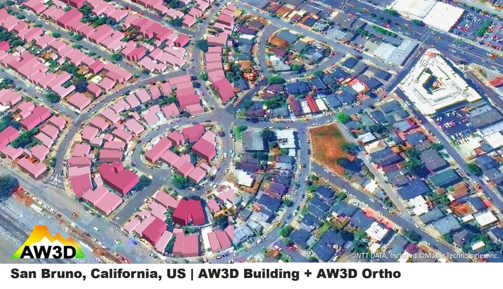
AW3D Enhanced Samples


Unsure if AW3D Enhanced is right for your project?
You shouldn’t have to be an expert in high-resolution satellite imagery to find what you need.
Our team is dedicated to making the process easy for you. All you have to do is tell us the problem. We find the answers from a vendor-agnostic perspective and present you with clear, simple solutions.
Tell us the problem
Explain the situation to us on your terms. We’ll translate it into the world of Satellite Imagery.
Review Your Options
Be presented with a simple choice of the top 2-3 imagery solutions for your project.
Make confident decisions
Know you have the right data in hand to make the critical decisions that keep your project moving forward.


