

Elevation 0.5, 1, 4
Airbus Defence and Space offers the most comprehensive range of Digital Elevation products and Ground Control Points based on space-borne optical and radar technologies. The latest addition, Elevation 0.5, uses Pléiades Neo 30cm satellite imagery to achieve industry-leading resolution and accuracy. This product suite supports applications like precision mapping and 3D modeling with exceptional detail.
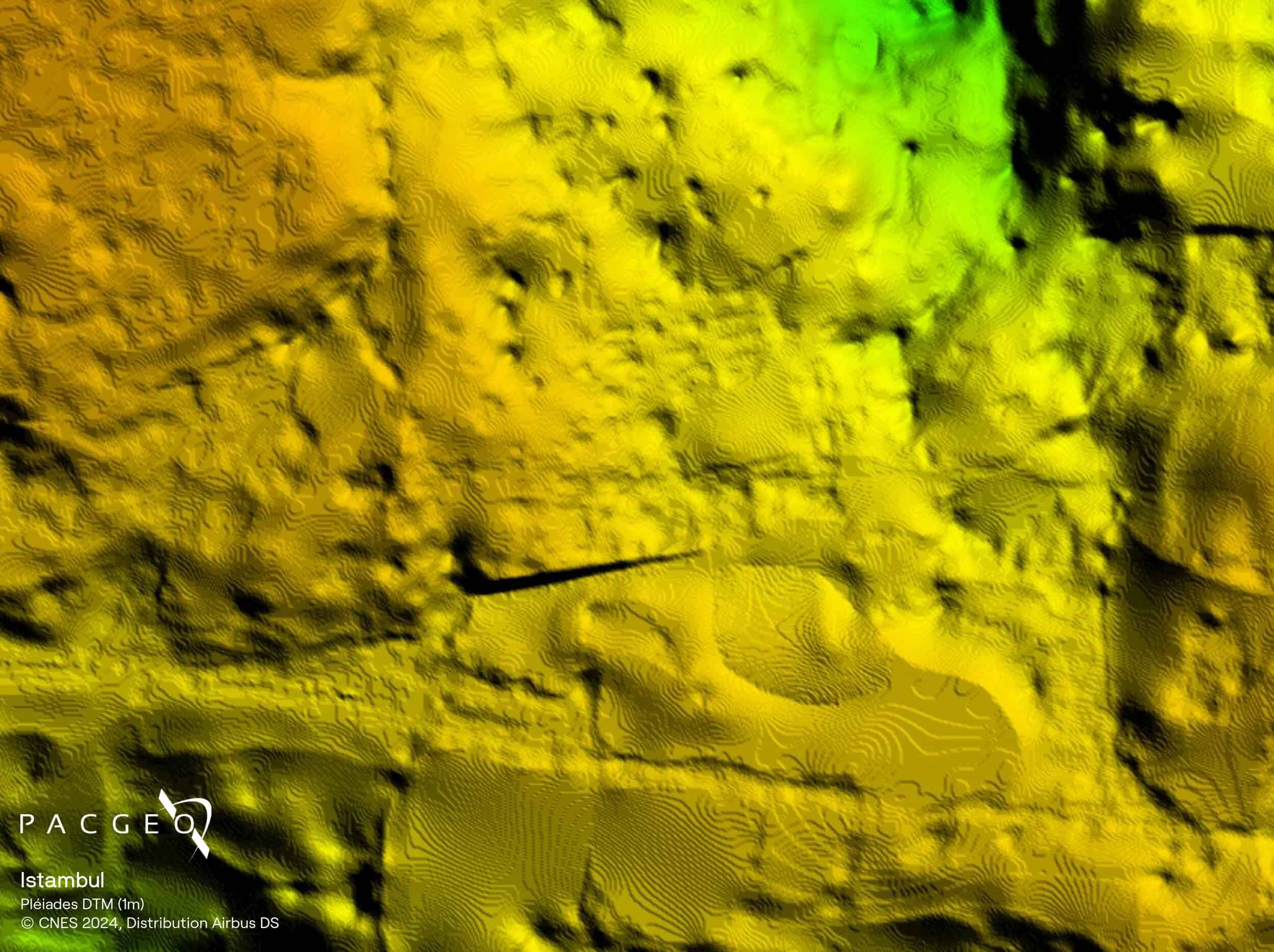
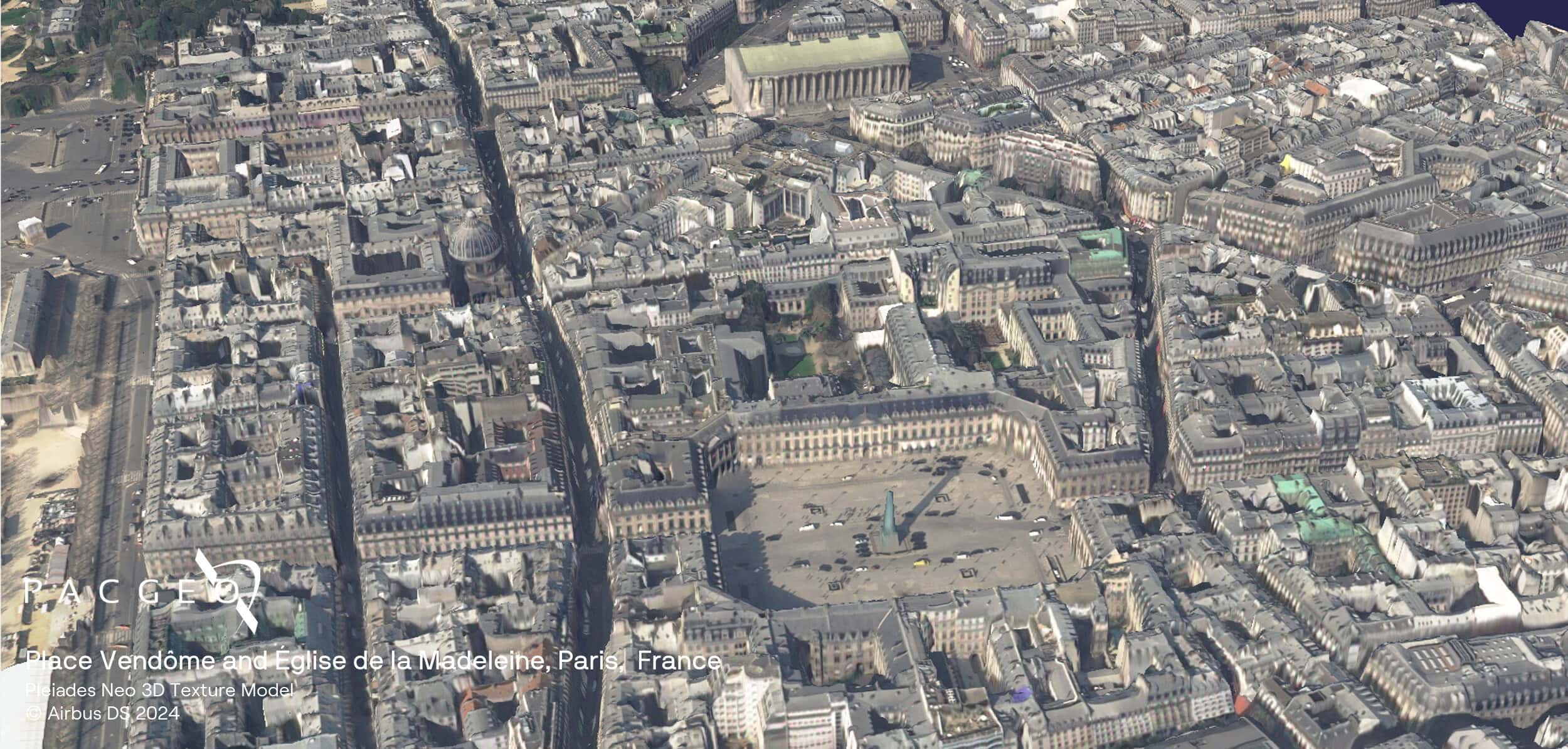
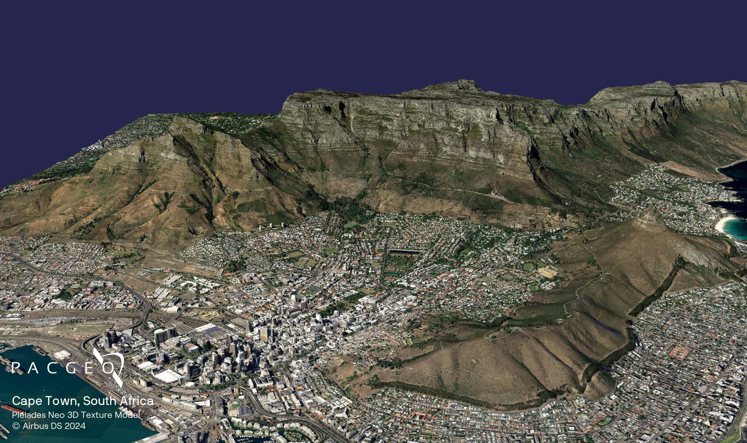
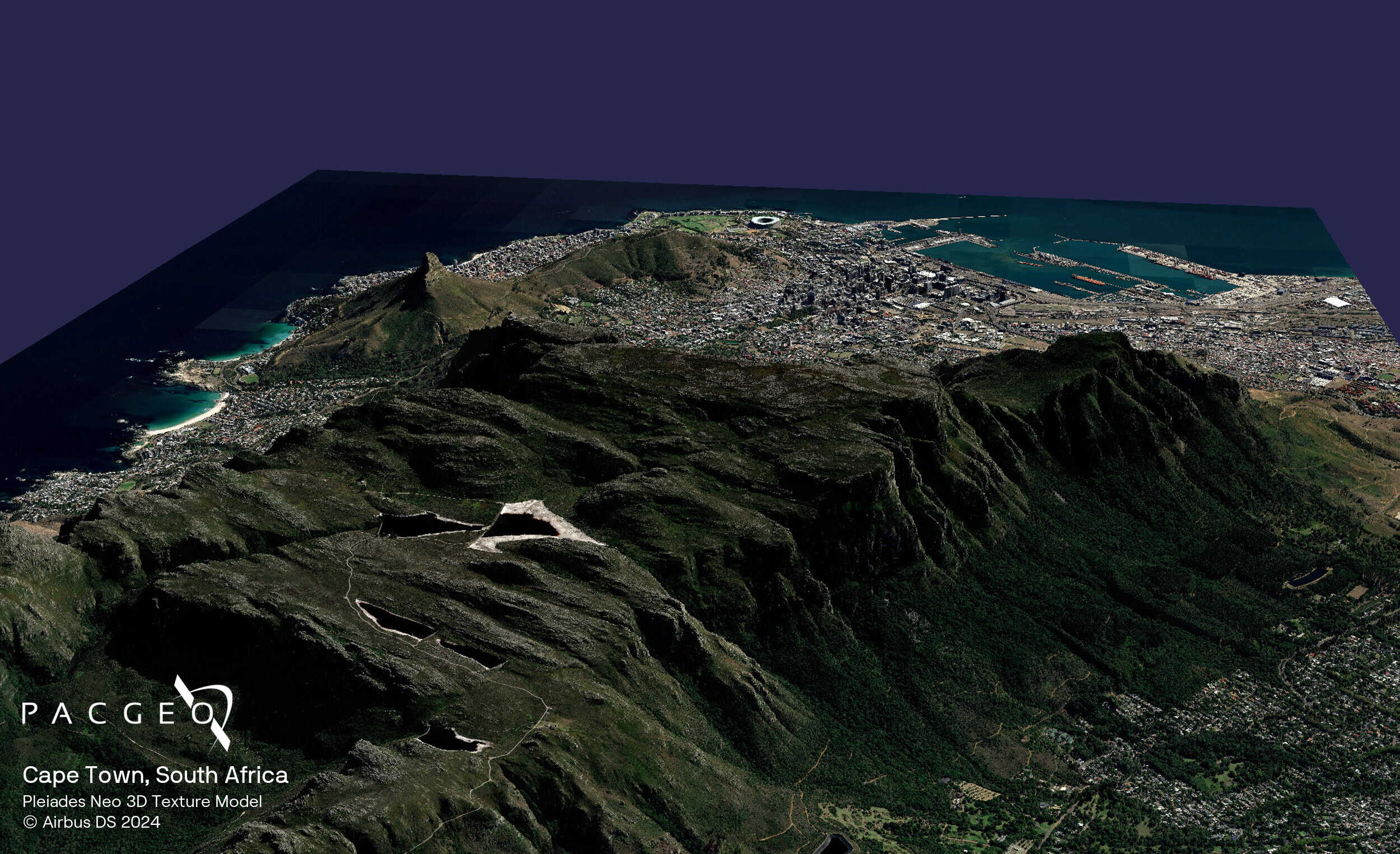
Elevation 0.5 provides a photorealistic 3D quality, capturing objects like trees and buildings with unprecedented clarity.
Resolution options of 0.5m, 1m, and 4m
Elevation 0.5 created from Pléiades Neo 30cm imagery
High relative and absolute accuracy
Available as DSM and DTM formats with optional 3D Textured Models
On-demand production ensures the most up-to-date data

Elevation 0.5, 1, 4 Specs
Product type
Digital Elevation Model (DEM):
Digital Surface Model (DSM)
Digital Terrain Model (DTM)
Spatial resolution
0.5 m, 1 m, 4 m
Coverage
Global, on-demand
Satellite data
Elevation 0.5 m: Based on Pléiades Neo stereo and tri-stereo imagery
Accuracy
Elevation 0.5 m with ground control points (GCPs):
Absolute: 1 m LE90
Relative: <1 m LE90
Elevation 1 m & 4 m without ground control points (GCPs):
Absolute: 1.5 m LE90
Minimum AOI
Flexible
Elevation 0.5, 1, 4 Samples


Unsure if Elevation 0.5, 1, 4 is right for your project?
You shouldn’t have to be an expert in high-resolution satellite imagery to find what you need.
Our team is dedicated to making the process easy for you. All you have to do is tell us the problem. We find the answers from a vendor-agnostic perspective and present you with clear, simple solutions.
Tell us the problem
Explain the situation to us on your terms. We’ll translate it into the world of Satellite Imagery.
Review Your Options
Be presented with a simple choice of the top 2-3 imagery solutions for your project.
Make confident decisions
Know you have the right data in hand to make the critical decisions that keep your project moving forward.


