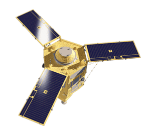
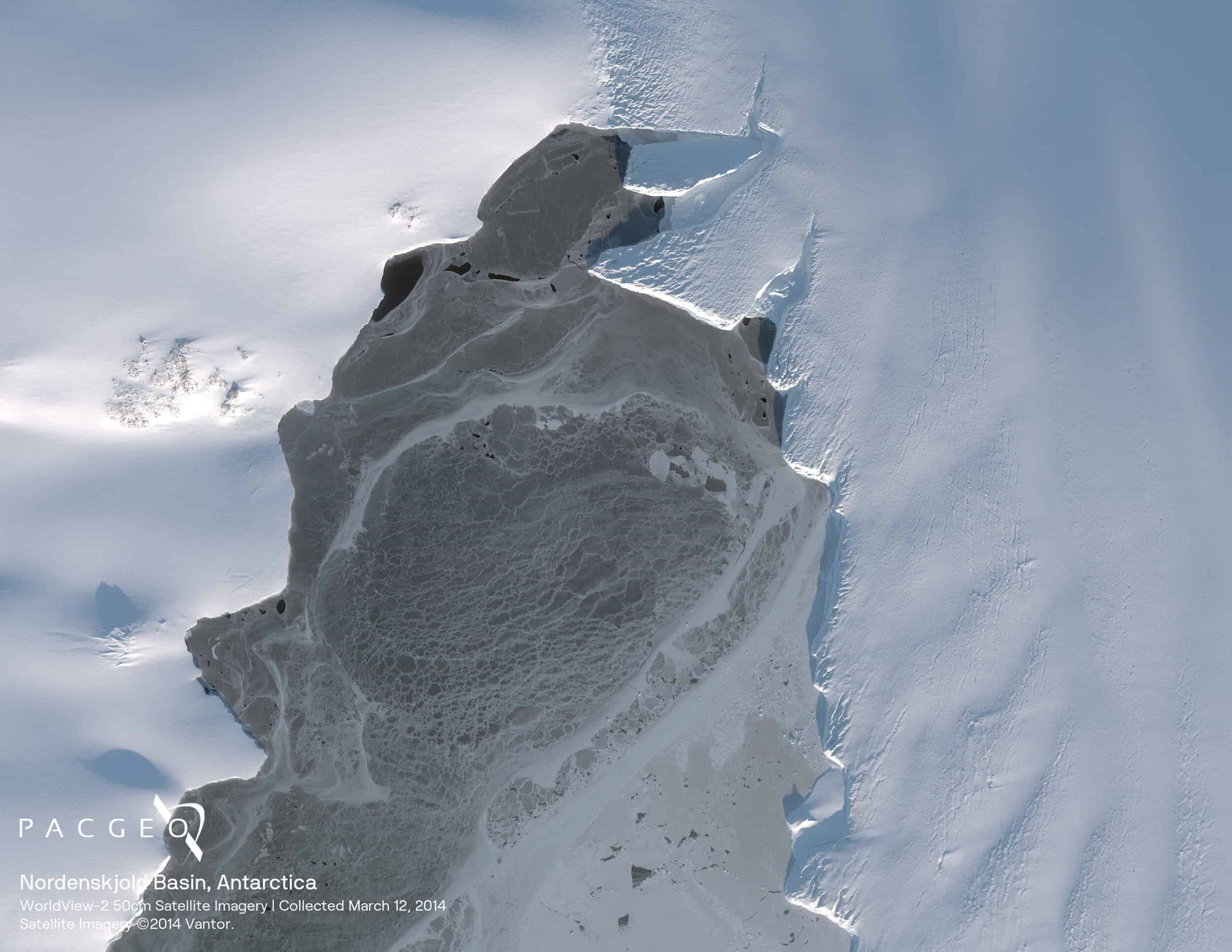
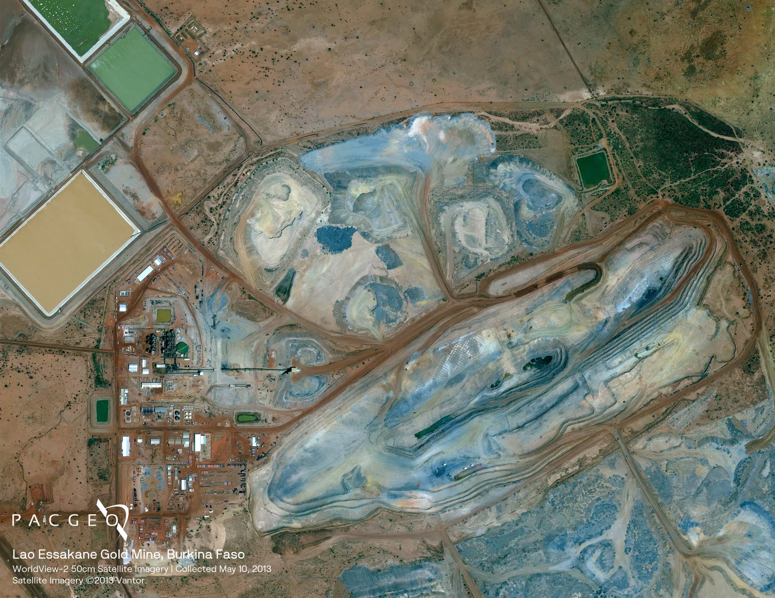
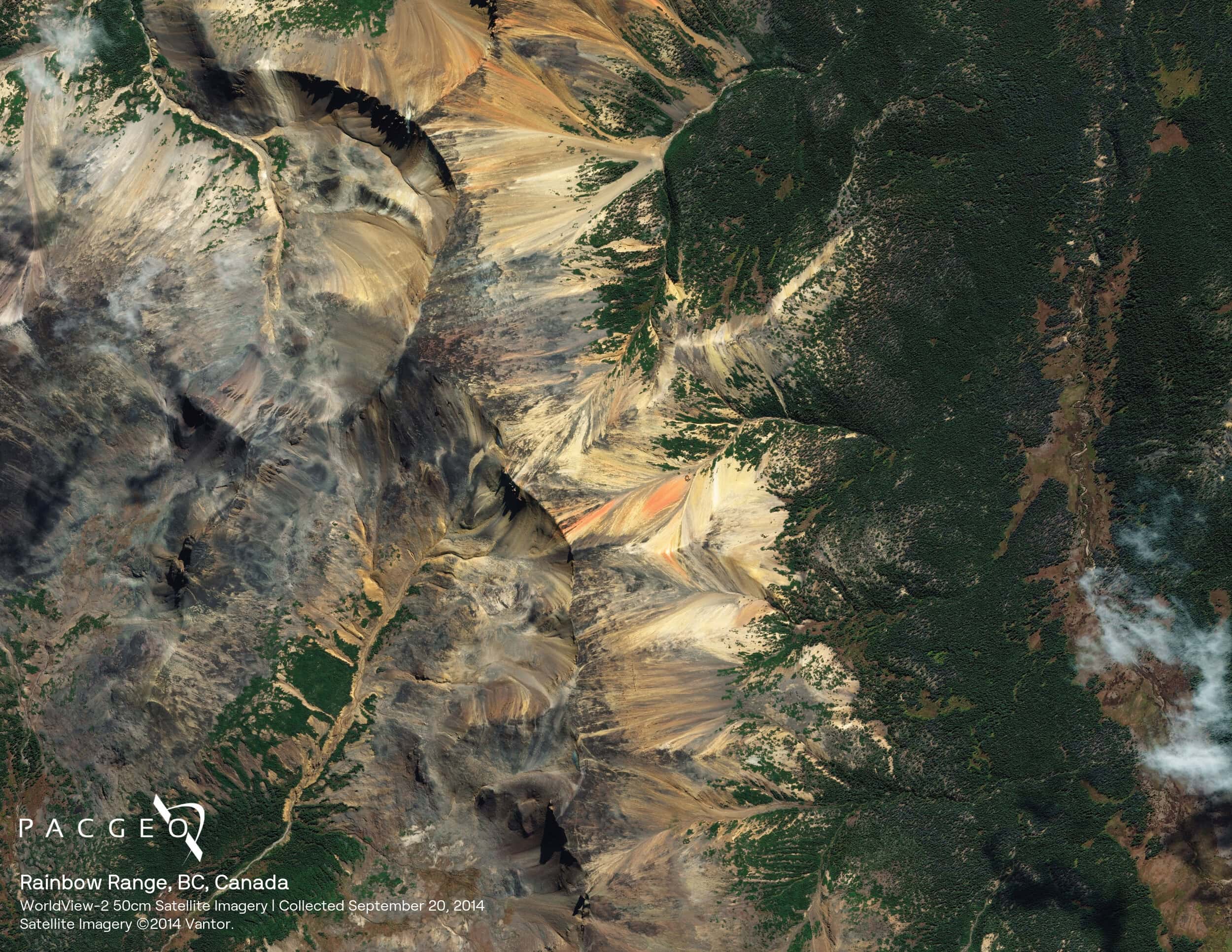
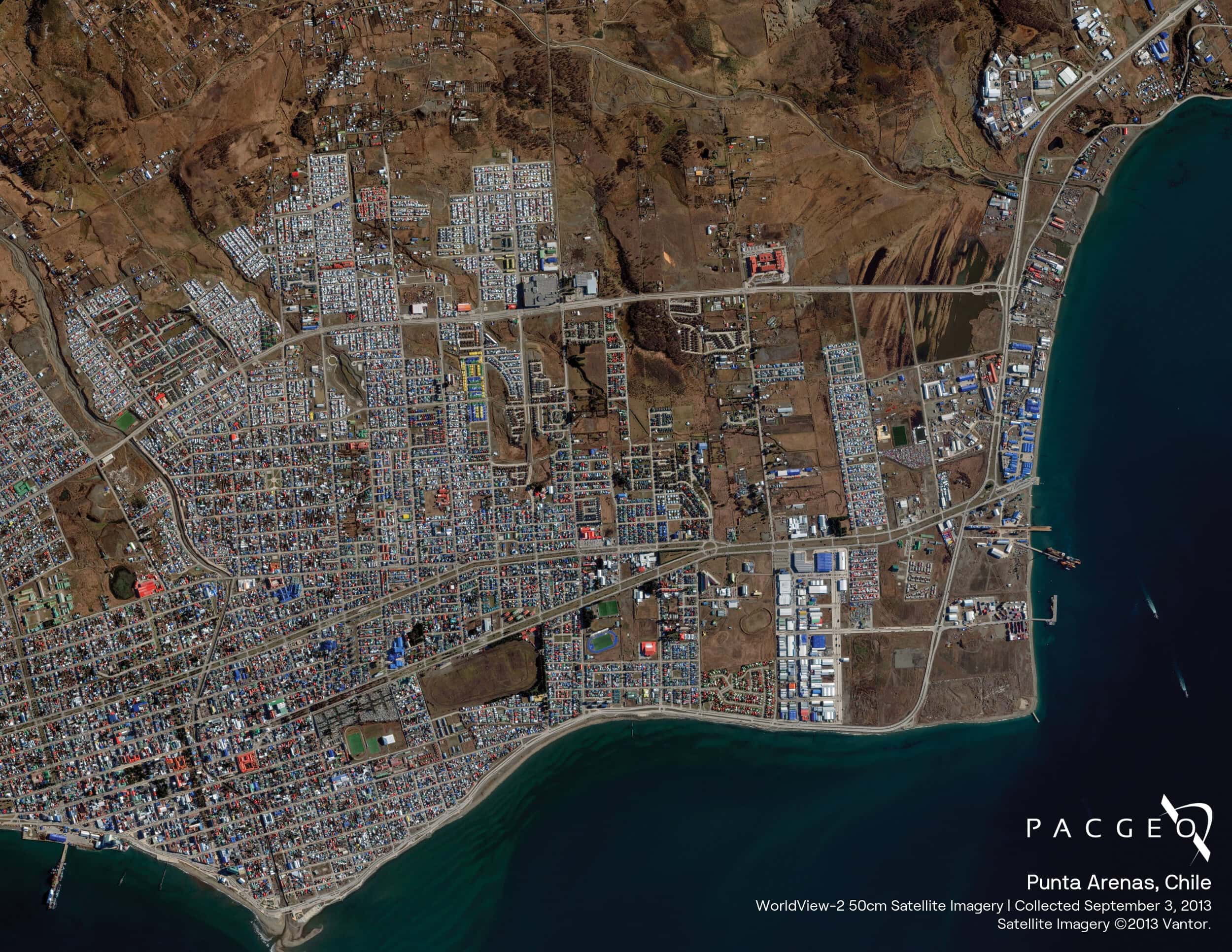
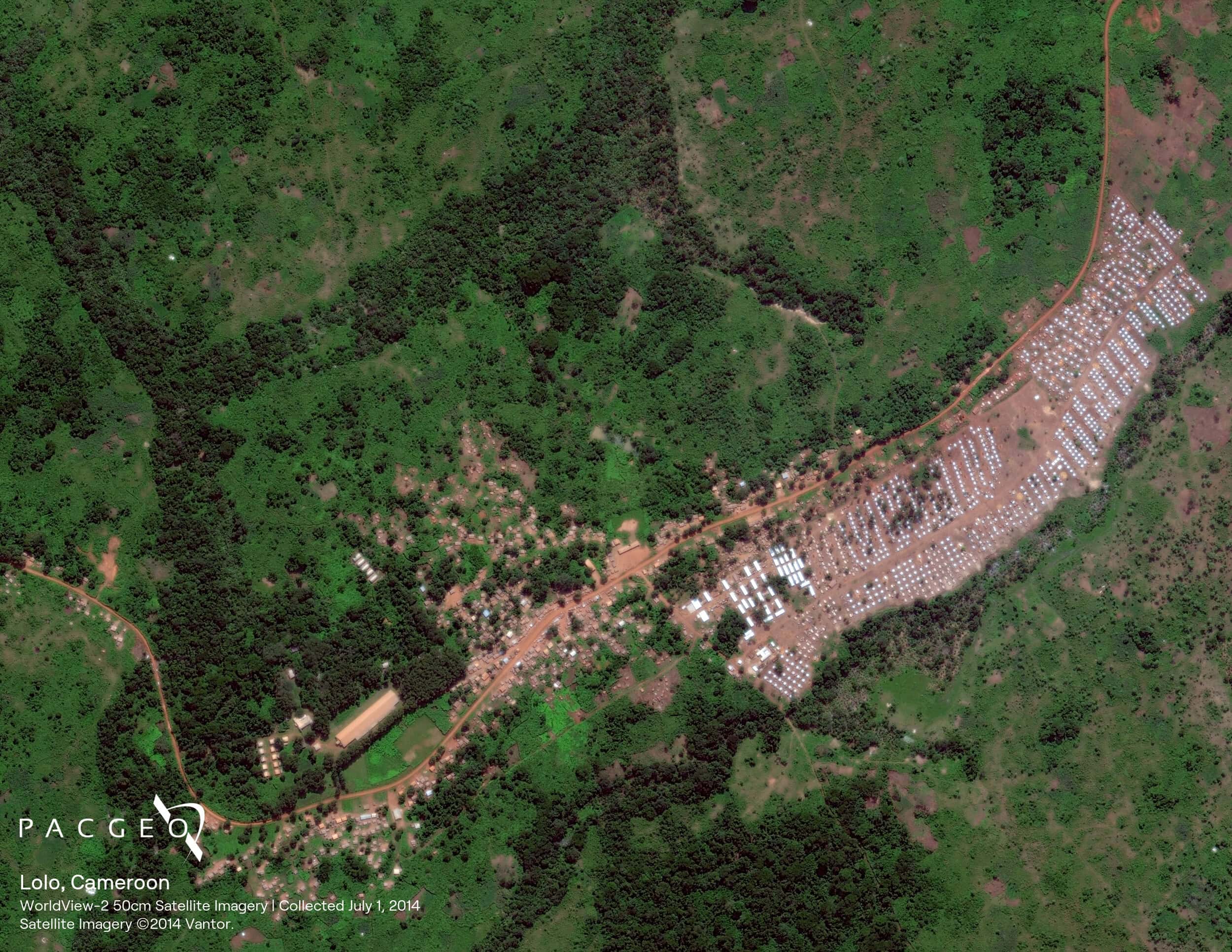
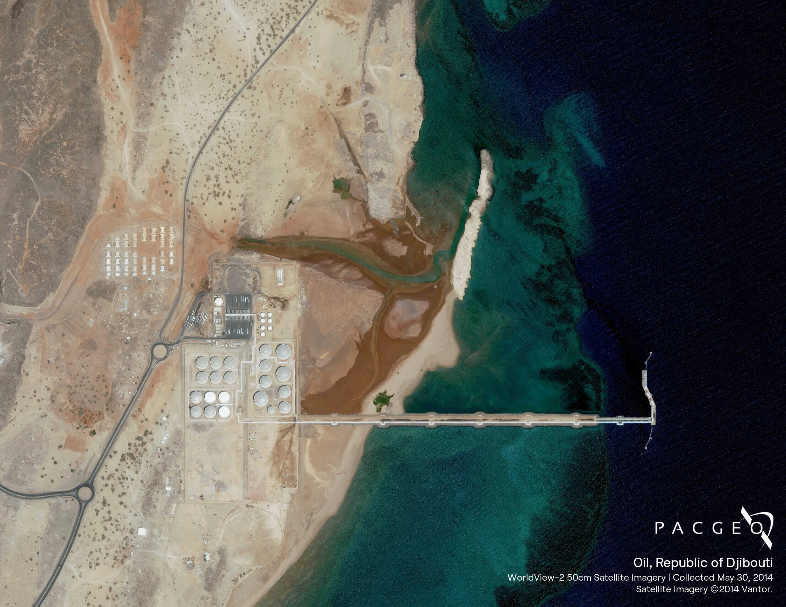
WorldView-2

Orbiting at an altitude of 770 km, WorldView-2 collects up to 1 million square kilometers of high-resolution 8-band imagery every day. It also offers industry-leading geolocation accuracy and stereoscopic collection on a single pass, ensuring greater image continuity.

Very High Resolution

The most spectral diversity commercially available

Frequent revisits at high resolution

Industry-leading geolocation accuracy

Bi-directional scanning

Ultra-stable platform, highprecision attitude sensors and GPS

Worldview-2

WorldView-2 Specs

Launch Information

Date: October 8, 2009
Launch Vehicle: Delta 7920 (9 strap-ons)
Launch Site: Vandenberg Air Force Base, California

Orbit

Orbit

Altitude: 770 km
Type: Sun synchronous, 10:30 am descending node
Period: 100 min.

spacecraft size

Spacecraft Size, Mass and Power

5.7 m (18.7 ft) tall x 2.5 m (8 ft) across
7.1 m (23 ft) across the deployed solar arrays
2615 kg (5765 lbs)
3.2 kW solar array, 100 Ahr battery

Sensor bands

Sensor Bands

Panchromatic: 450 – 800 nm 8 Multispectral

Sensor Resolution

Sensor Resolution

Panchromatic: 0.46 m GSD at nadir, 0.52 m GSD at 20° off-nadir
Multispectral: 1.85 m GSD at nadir, 2.07 m GSD at 20° off-nadir

Dynamic Range

Dynamic Range

11-bits per pixel

Swath

Swath Width

16.4 km at nadir

Attitude

Attitude Determination & Control

3-axis stabilized
Actuators: Control Moment Gyros (CMGs)
Sensors: Star trackers, solid state IRU, GPS

Point accuracy

Pointing Accuracy & Knowledge

Accuracy: <500 m at image start and stop
Knowledge: Supports geolocation accuracy below

Retargeting

Retargeting Agility

Time to slew 200 km: 10 sec

Max Contiguous

Onboard Storage

2199 GB solid state with EDAC

Communications

Communications

Image and Ancillary Data: 800 Mbps X-band
Housekeeping: 4, 16 or 32 kbps realtime, 524
kbps stored, X-band
Command: 2 or 64 kbps S-band

Max Contiguous

Max Contiguous Area Collected in a Single Pass (30° off-nadir)

Mono: 138 x 112 km (8 strips)
Stereo: 63 x 112 km (4 pairs)

Revist

Revisit Frequency (at 40°N Latitude)

1.1 days at 1 m GSD or less
3.7 days at 20° off-nadir or less (0.52 m GSD)

Geolocation

Geolocation
Accuracy (CE90)

Demonstrated <3.5 m CE90 without ground control

capacity

Capacity

1 million sq km per day

Unsure if
WorldView-2 is right
for your project?

You shouldn’t have to be an expert in high-resolution satellite imagery to find what you need.

Our team is dedicated to making the process easy for you. All you have to do is tell us the problem. We find the answers from a vendor-agnostic perspective and present you with clear, simple solutions.

Tell us the problem

Explain the situation to us on your terms. We’ll translate it into the world of Satellite Imagery.

Review Your Options

Be presented with a simple choice of the top 2-3 imagery solutions for your project.

Make confident decisions

Know you have the right data in hand to make the critical decisions that keep your project moving forward.

Other Satellites

image 35

Planet

PlanetScope

This constellation of approximately 130 satellites is constantly growing and improving, thanks to ongoing technology deployments. Combined, the constellation can image the entire land surface of Earth each day.

image 34

Airbus

SPOT-6/7

The SPOT twins operate in phased orbits and can revisit any point on the globe once per day. They deliver 1.5-meter high-resolution imagery across five spectral bands and can capture 6 million square kilometers per satellite per day.

image 29

MAXAR

GeoEye-1

Ideal for large-scale mapping projects, GeoEye-1 provides highly detailed imagery at .46-meter panchromatic and 1.84-meter multispectral resolutions. It can geolocate features to less than 5m, offers stereoscopic collection on a single pass, and can revisit any point on Earth once every three days.

When we need high-resolution satellite imagery, we trust Pacgeo for their quality imagery and reliable turnaround times. ​

David Bluestone

Vice President of Exploration, Bluestone Resources

Ordering high-res satellite imagery through a partner agency order desk was always painful and fraught with multiple issues. Dealing directly with Pacgeo allows me to bypass the aforementioned issues, while getting quick and reliable access to the data I need.

Government Employee

Government of Canada