

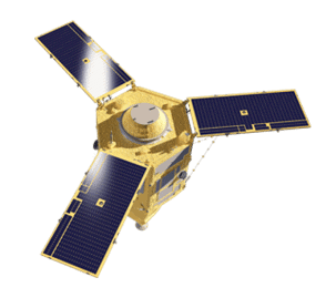
SPOT-6/7
The SPOT twins operate in phased orbits and can revisit any point on the globe once per day. They deliver 1.5-meter high-resolution imagery across five spectral bands and can capture 6 million square kilometers per satellite per day.
Daily acquisition capacity of 6 million km² per satellite.
High-resolution products with five spectral bands
Daily revisit, anywhere

Spot – 6/7 Specs

Launch Information
Date: September 9, 2012
Launch Vehicle: Delta PSLV
Launch Site: Satish Dhawan Space Center (India)

Orbit
Altitude: 496 km
Type: Sun synchronous
Period: 95 min.

Spacecraft Size, Mass and Power
Body: ~ 1.55 m x 1.75 m x 2.7 m
Solar array wingspan area: 5.4 m2

Sensor Bands
Blue (0.455 µm – 0.525 µm)
Green (0.530 µm – 0.590 µm)
Red (0.625 µm – 0.695 µm)
Near-Infrared (0.760 µm – 0.890 µm)

Sensor Resolution
Panchromatic – 2m
Multispectral – 8m

Dynamic Range
12-bits per pixel

Swath Width
60 km (2 imagers)
120 km with single pass mosaic

Attitude Determination & Control
The enhanced 3-axis stabilization attitude control system is based on a set of 4 RW (Reaction Wheels) for fine-pointing with 3 MTQ (Magnetic Torquers) for off-loading. In case of very high agility requirements, the reactions wheels are replaced by Astrium patented CMGs (Control Moment Gyros).

Pointing Accuracy & Knowledge
Accuracy of up to 500 µrad (3σ)

Retargeting Agility
Ultimate satellite agility, enabling to achieve efficiently both collection of large coverage and collection of individual targets: more than 3 million km2 per day for each satellite

Revisit Frequency (at 40°N Latitude)
1 (45º) to 5 days (30º)

Geolocation
Accuracy (CE90)
35 m without GCP; < 10 m with Ref3D

Capacity
3 million sq km
Unsure if
SPOT-6/7 is right
for your project?
You shouldn’t have to be an expert in high-resolution satellite imagery to find what you need.
Our team is dedicated to making the process easy for you. All you have to do is tell us the problem. We find the answers from a vendor-agnostic perspective and present you with clear, simple solutions.
Tell us the problem
Explain the situation to us on your terms. We’ll translate it into the world of Satellite Imagery.
Review Your Options
Be presented with a simple choice of the top 2-3 imagery solutions for your project.
Make confident decisions
Know you have the right data in hand to make the critical decisions that keep your project moving forward.
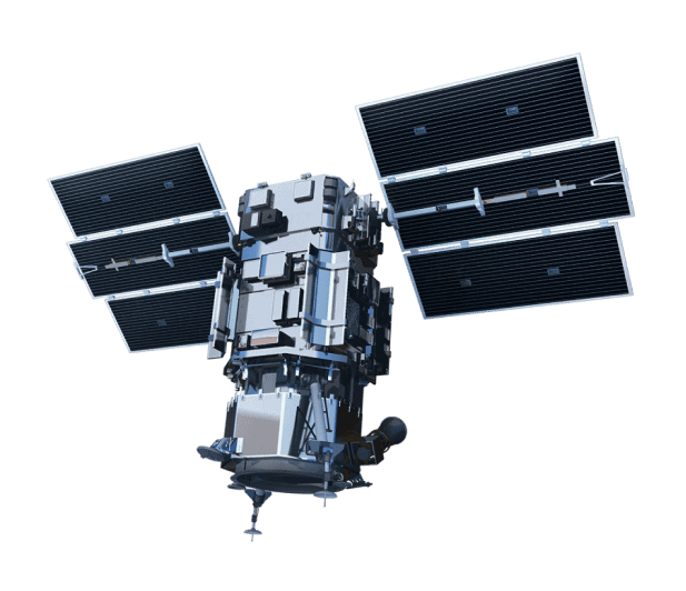
Other Satellites
When we need high-resolution satellite imagery, we trust Pacgeo for their quality imagery and reliable turnaround times.
David Bluestone
Vice President of Exploration, Bluestone Resources
Ordering high-res satellite imagery through a partner agency order desk was always painful and fraught with multiple issues. Dealing directly with Pacgeo allows me to bypass the aforementioned issues, while getting quick and reliable access to the data I need.
Government Employee
Government of Canada
