Capella Space

Capella Space

Capella Space is an Earth observation company that provides timely and reliable visibility with its Synthetic Aperture Radar (SAR) small sat constellation. Capella is the first U.S. company to launch and operate commercial SAR and offers the highest resolution imagery available. Capella’s novel satellites are matched with a market-leading cloud infrastructure delivering global insights to Defense & Intelligence, government and commercial customers.

High Quality – Very high-resolution satellite imagery combined with noise reduction leads to unmatched image clarity

Timely – Rapid fully-automated order-to-delivery means faster speed to insight.

Frequent – Increasing high-cadence revisit timeframes as our constellation grows.

Accessible – Intuitive online platform with self-serve catalog search, ordering and tasking.

Capella Space

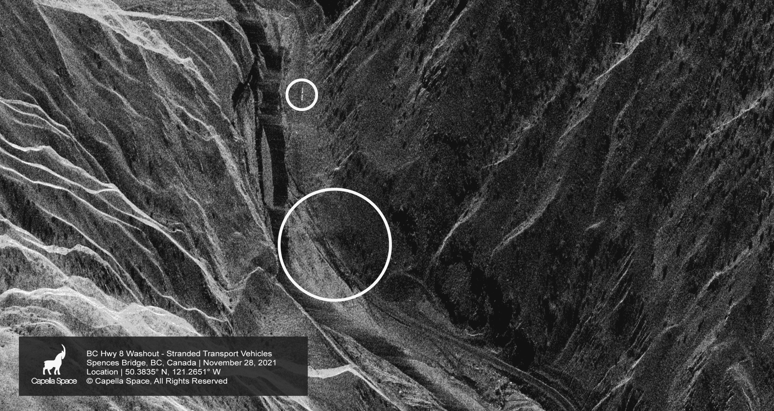
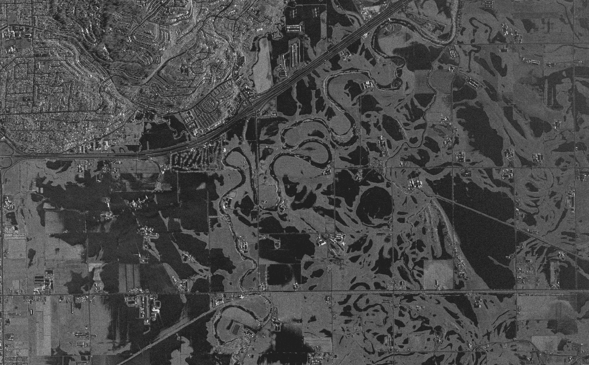
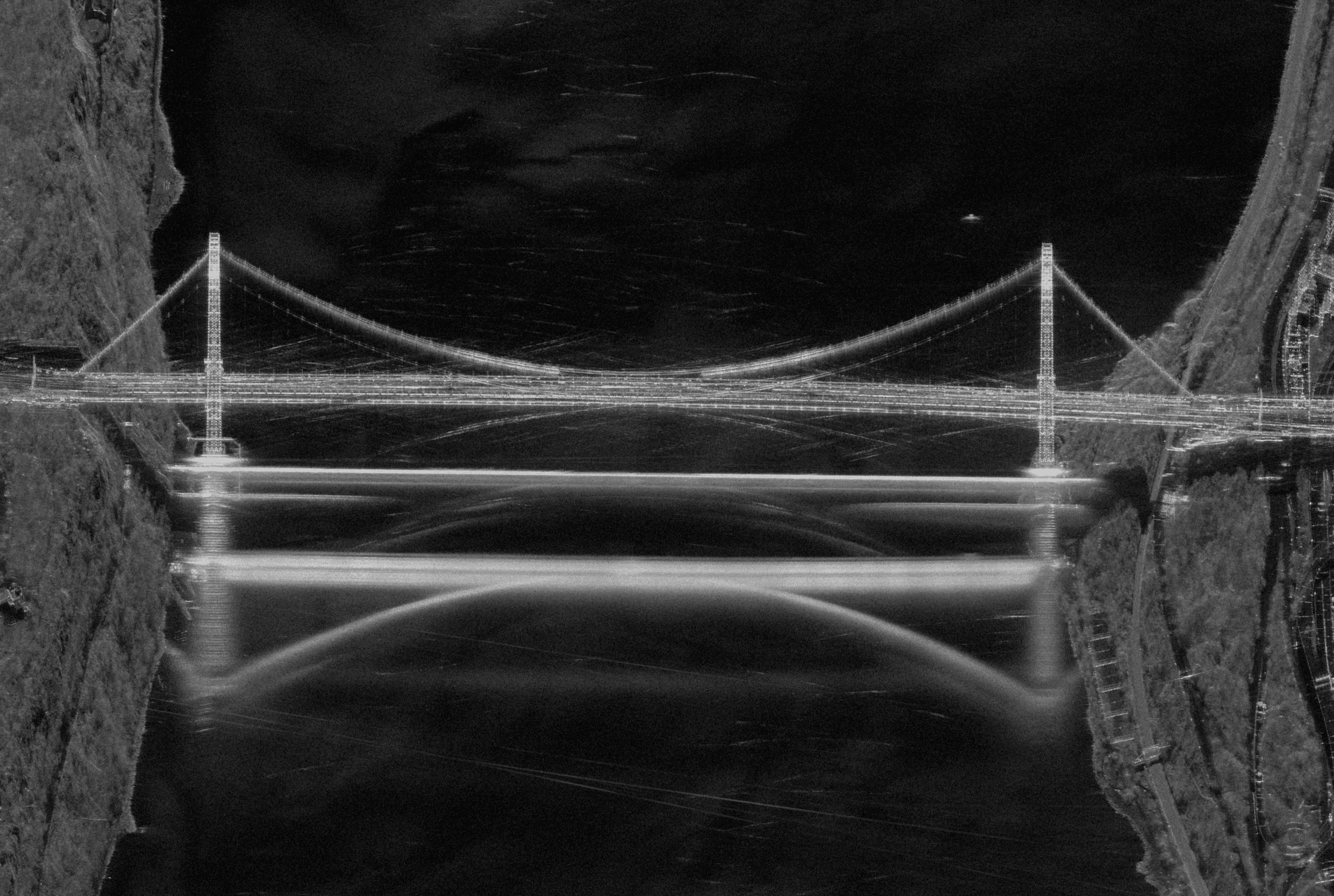
Capella Space Samples

Capella Space “Sliding Spotlight” 1m resolutions (5km x 10km footprint) Taken during the 2021 BC Floods collected a tough Mountain Valley image of the BC Hwy 8 washout bear Merritt BC
Commercial Satellite Imagery
2021 BC Floods. Capella Space SAR imagery of Sumas BC collected on1 Dec 2021 at 0122 hrs local. The imagery was delivered to NRCan, DND, BC Government 3.5hrs after collection! One of the advantages of Synthetic-aperture radar (SAR) is it can capture imagery at night and during inclement weather. For this shot the “Imaging Mode” chosen was the “Stripmap” although lower resolution at 1.2m compared 50cm for “Spotlight” , it has a much larger footprint of 10km x 20kms to capture the flooding.
Commercial Satellite Imagery
Maintaining situational awareness at night or harsh weather is always challenging. In contested environments UAVs may not be an option. Older SAR sensors may not have the resolution to identify military target or cannot rapidly be tasked. That’s why I’m very excited that PacGeo is now a reseller of @capellaspace 50cm SAR data. Giving our clients new insight from the most frequent, timely and high-quality SAR imagery products available. All weather 24/7 Anywhere Photo: 50cm SAR images of the India- China Border Region
Capella Shot
Capella shot of the George Washington Bridge NYC.

Unsure if Capella Space is right for your project?

You shouldn’t have to be an expert in high-resolution satellite imagery to find what you need.

Our team is dedicated to making the process easy for you. All you have to do is tell us the problem. We find the answers from a vendor-agnostic perspective and present you with clear, simple solutions.

Tell us the problem

Explain the situation to us on your terms. We’ll translate it into the world of Satellite Imagery.

Review Your Options

Be presented with a simple choice of the top 2-3 imagery solutions for your project.

Make confident decisions

Know you have the right data in hand to make the critical decisions that keep your project moving forward.

Other Satellites

pleiades

Airbus

Pleiades-1A/1B

The Pleiades satellites work as a pair in phased orbits, and can perform daily revisits to any point on Earth. They provide highly detailed imagery at 50cm panchromatic resolution as well as 2m multispectral resolution.

image 20

MAXAR

WorldView-2

Orbiting at an altitude of 770 km, WorldView-2 collects up to 1 million square kilometers of high-resolution 8-band imagery every day. It also offers industry-leading geolocation accuracy and stereoscopic collection on a single pass, ensuring greater image continuity.

image 29

MAXAR

GeoEye-1

Ideal for large-scale mapping projects, GeoEye-1 provides highly detailed imagery at .46-meter panchromatic and 1.84-meter multispectral resolutions. It can geolocate features to less than 5m, offers stereoscopic collection on a single pass, and can revisit any point on Earth once every three days.

When we need high-resolution satellite imagery, we trust Pacgeo for their quality imagery and reliable turnaround times. ​

David Bluestone

Vice President of Exploration, Bluestone Resources

Ordering high-res satellite imagery through a partner agency order desk was always painful and fraught with multiple issues. Dealing directly with Pacgeo allows me to bypass the aforementioned issues, while getting quick and reliable access to the data I need.

Government Employee

Government of Canada